200 km across the Caucasus. Georgia

At 2021, for my already traditional solo trek, I chose a route through the Caucasus Mountains... Over seven days, I covered approximately 200 kilometers, ascending over three thousand meters each day... My route passed through wild areas of the Georgian Caucasus, where there were almost no "tourists" and communication was completely absent throughout all seven days... Passes of high-altitude meadows and shepherd camps, where sheep and cows grazed, were guarded by "wolfhound" shepherd dogs, which attacked every time the trail passed within 200 meters of the herd...
Map of the route:
Arriving in the village of Juta, I began my hike by ascending to Chaukhi Pass, at an altitude of 3338 meters...


Upon reaching Abudelauri Lakes, I set up my tent and immediately lay down to sleep, as my head was aching from the altitude and sleepless night, following the flight and long journey to Juta village... Altitude 2610 meters...


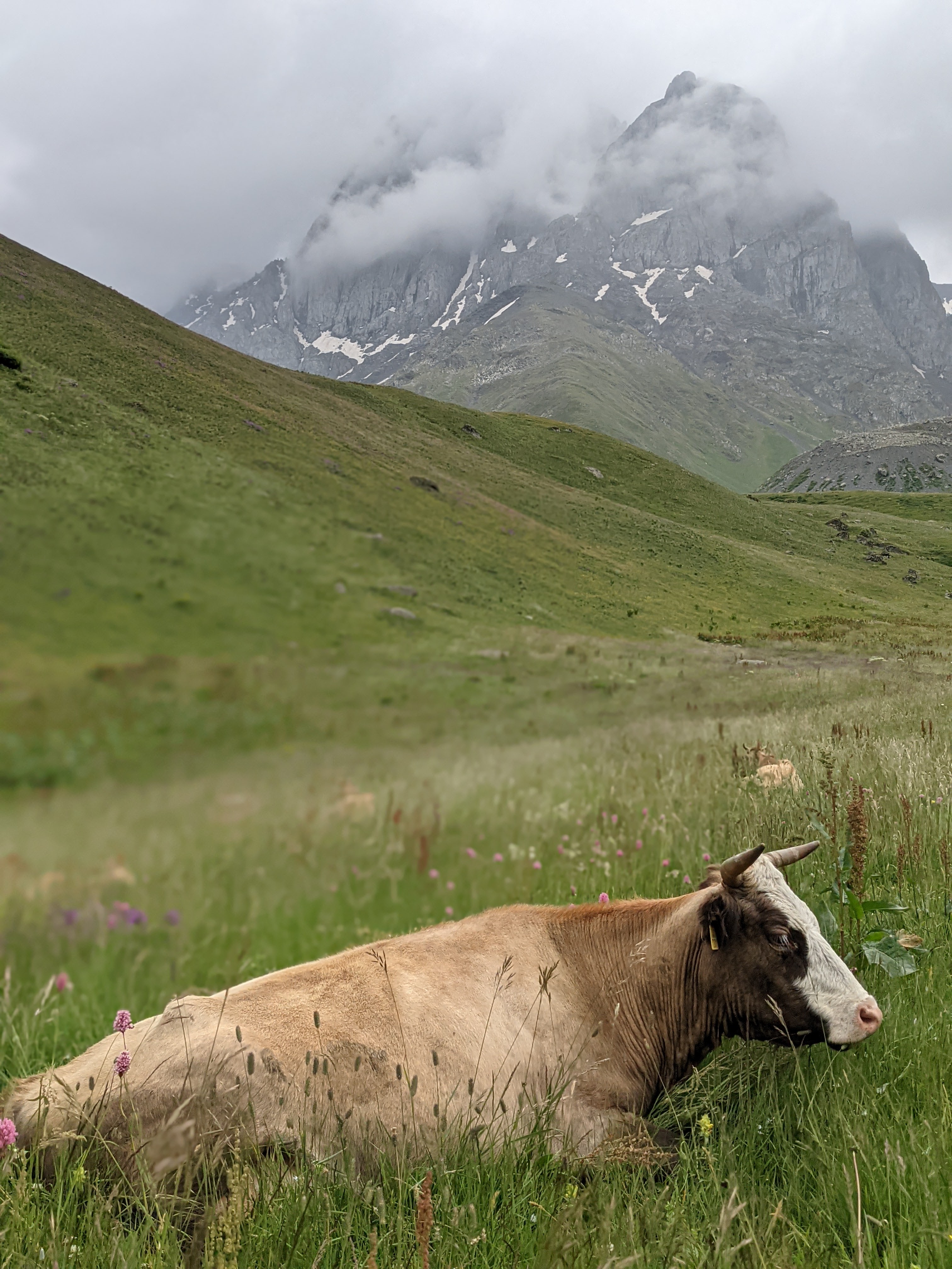
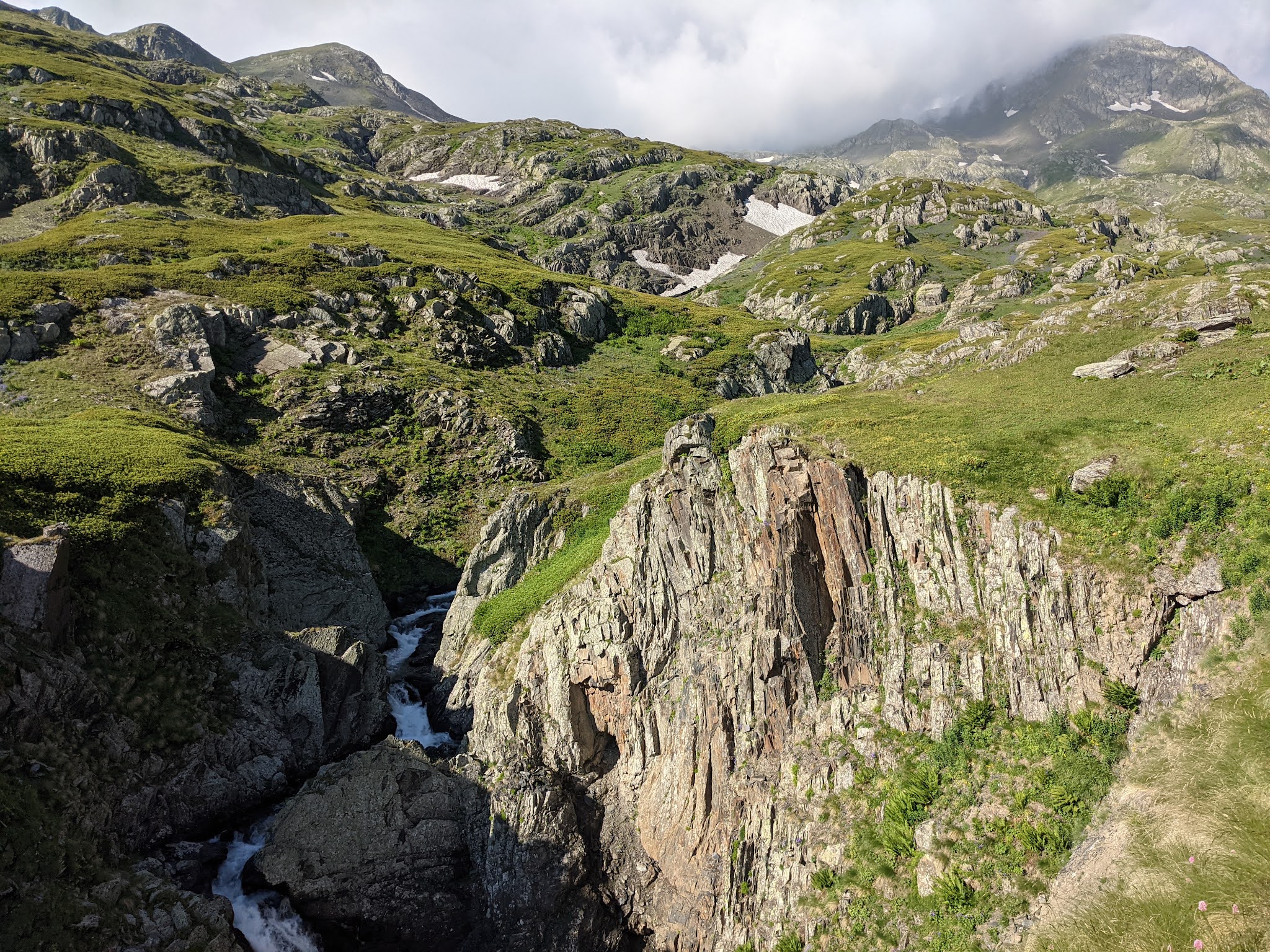
Descending into the gorge and passing through the village of Roshka, I again began to climb a ridge that somehow resembled our Carpathians... Rocky peaks, near which I spent the first night, were already far behind...


Although the ridges resemble the Carpathians, the altitudes far exceed "our mountains"... Altitudes range from 2700 to 3000 meters...


Reaching Datvijvari Pass, I pitched my tent on one of the clearings above the mountain road at an altitude of 2650 meters...


The next morning, I passed a "checkpoint" with shepherd dogs, and then after crossing the pass, I walked for almost 12 kilometers along the gorge beside the river, passing the same checkpoints with constant dog attacks... In some places, the shepherds didn't even come out of their huts to help me pass... The trail was relatively good but went from one side of the river to the other, with homemade bridges for crossing...


Ascending a mountain ridge, along which the path continued to Atsunta Pass, I had a view of my entire path, which I passed through the gorge...


Since my route ran through border territory, I had to pass through the border guards' checkpoint, whose building was located on the ridge...


I spent the night under Atsunta Pass at an altitude of 3000 meters...


Descending from the pass and passing through the valleys for almost 8 kilometers, I turned towards the next ridge and the next pass...


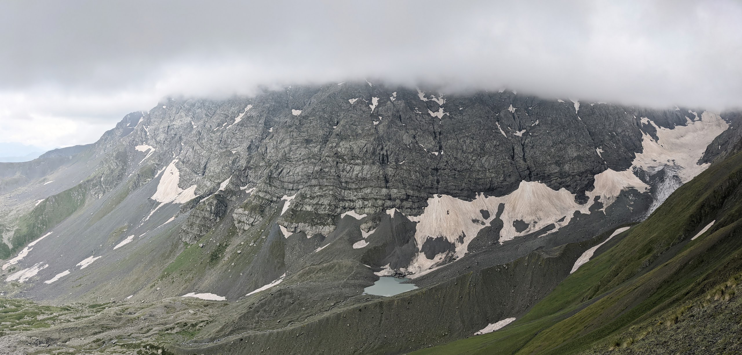
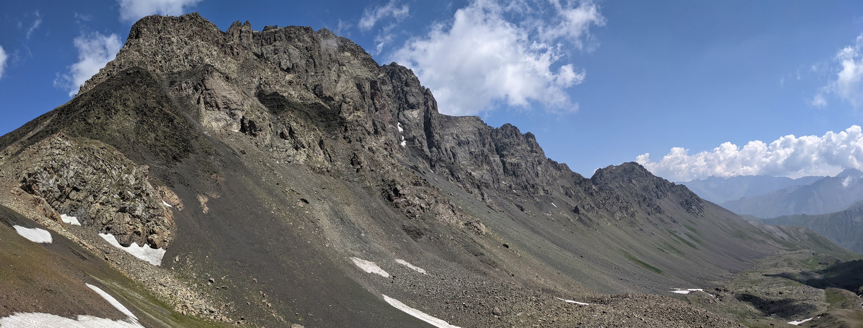
The border guards warned me about the danger of the pass... When I approached the main ascent, I realized they were right... There was still frozen snow on the main trail, which was impossible to climb without crampons and an ice ax, and bypassing the trail through loose scree and icy rock was not only unrealistic but also extremely dangerous, as one could not only slip but also be buried under a pile of rocks hanging on the slope... Since I didn't have crampons or an ice ax, and I didn't want to go back either, I decided to start making steps in the snow... Finding a sharp stone, I slowly dug steps; it was a very slow and difficult but the safest way to move forward...


For about an hour, I covered 150 meters of distance, digging a hole over 20 cm deep for each step... After passing through the snow tongue, I had to go through an even more dangerous section over loose stones, carefully considering each move... At the summit of the pass, there were beautiful views, but all thoughts were about how to descend now over the loose slope to the bottom...


On the other side of the ridge, the slope angle was not so steep, and I could simply run down the scree as if on a sandy slope... This pass was the most difficult and dangerous I have ever overcome... Further, the descent went along an aggressive rocky valley...

Crossing a full-flowing mountain stream with a swift current, which more resembled a mountain river, was also an interesting element of the route...


Descending into the valley with a more friendly relief, I found a good place to spend the night... Altitude 2200 meters...

The next morning, I continued my path through the gorge and gradually approached the path leading to the ridge...

Next to the path stood a shepherd's hut, which meant another meeting with the dogs... The shepherd was not around, but the dogs followed me until I caught up with him... The shepherd not only calmed the aggression of his helpers but also removed a healthy green spider from my hat, which he said was deadly... This is how almost every day passed cheerfully for me in the mountains of the Caucasus... Borbalo Pass 2980 meters...


Passing another sheep pasture checkpoint, I encountered the most dangerous attack by shepherd dogs... I was used to the fact that two or three dogs could guard a sheep flock and usually started barking at least a hundred or two hundred meters away... And here I'm walking along the trail, and I'm already quite close to the flock, but the dogs are silent... As soon as the first dog saw me, emerging from among the sheep, it started barking and quickly approaching... I turned my head and saw a pack of six dogs flying towards me from the other side of the mountain, and behind them was a shepherd running with all his might... Adrenaline surged... The dogs immediately surrounded me in a tight circle and tried to attack one by one... I spun around with a stick and kept them at a distance; I had to hold out until the shepherd ran to rescue me... When the shepherd ran up, he immediately yelled at me to sit down and began waving his stick to fend off the attack... The battle between the shepherd and his dogs lasted about 10 minutes, after which they backed off a bit, and the shepherd managed to lead me beyond the hill so that I could safely continue my journey... After this adventure, I understood the main rule of encountering a pack of wolfhounds - you have to sit down and not move, keeping the distance with a stick and waiting for the shepherd's help, and where there are dogs, there must be a shepherd for sure...


After crossing the last pass planned for today and passing another shepherd's checkpoint, I visited one of them, who, after driving away his dogs, invited me to visit him for dinner... He had just returned from a settlement where he bought bread and cheese... Enjoying the taste combination of simple but real products - cheese, bread, and pink tomatoes for dessert, I spent almost two hours talking with a person who has been living in the mountains for more than 5 months without electricity, internet, and all the comforts we are so used to, and heard how he perceives the surrounding world... The shepherd's name was Zuliko, and his ancestors were originally from Azerbaijan. He is from a Georgian village where Azerbaijanis live completely... Previously, he usually went to work in Moscow, and after the visa restrictions, he was forced to work as a shepherd, which, according to him, is much harder and not so profitable... Interestingly, when a person tells how much he liked living in Moscow in a rented apartment, working in construction, and relaxing in the evening - walking, and returning home after six months of work with some money... That is, ordinary life for us, is like paradise for him...


Warmly saying goodbye to the shepherd, I walked a little more and found a nice clearing to pitch a tent...


In the morning, I climbed to Datvijvari Pass, and from there to the mountain ridge... The trail of about 11 kilometers passed at altitudes of 2800-3100 meters, sometimes bypassing the mountain peaks and sometimes passing over the tops...


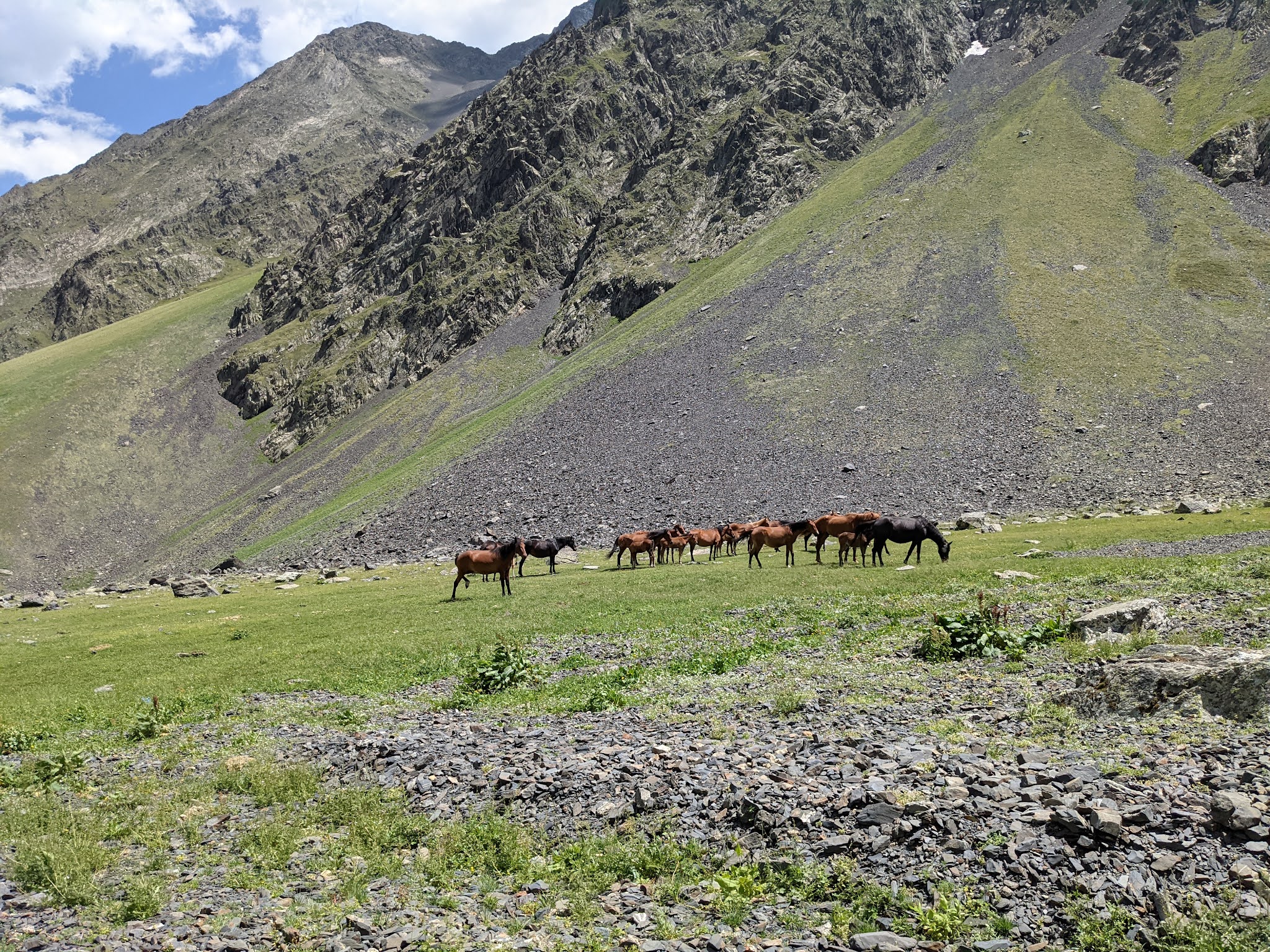


Around the lake, a herd of bulls grazed... Refreshing in the cold waters of the lake, I continued my descent...


Descending into the gorge, I came across another border checkpoint... It was located in the wildest place of all, so the border guards were the most hospitable there... They not only checked the documents but also invited me to eat... I gladly agreed, and they fed me with classic Georgian lamb ragout - khachapuri... By the way, when the border guards heard that I was from Ukraine, a smile flashed on their faces, and they said, "Ukraine, Our Friends"...

After a good dinner, I was waiting for passage along a wild path that ran through the gorge along the mountain full-flowing stream... Seven kilometers of a very difficult passage through thickets of nettles, blackberries, thorns, crossing from one side of the river to the other, trails along rocky and rocky shores...


In many places, there were homemade bridges, and sometimes it was necessary to cross the river waist-deep...

After the trail that more resembled an obstacle course, I stopped for the night in a picturesque place near the stream...

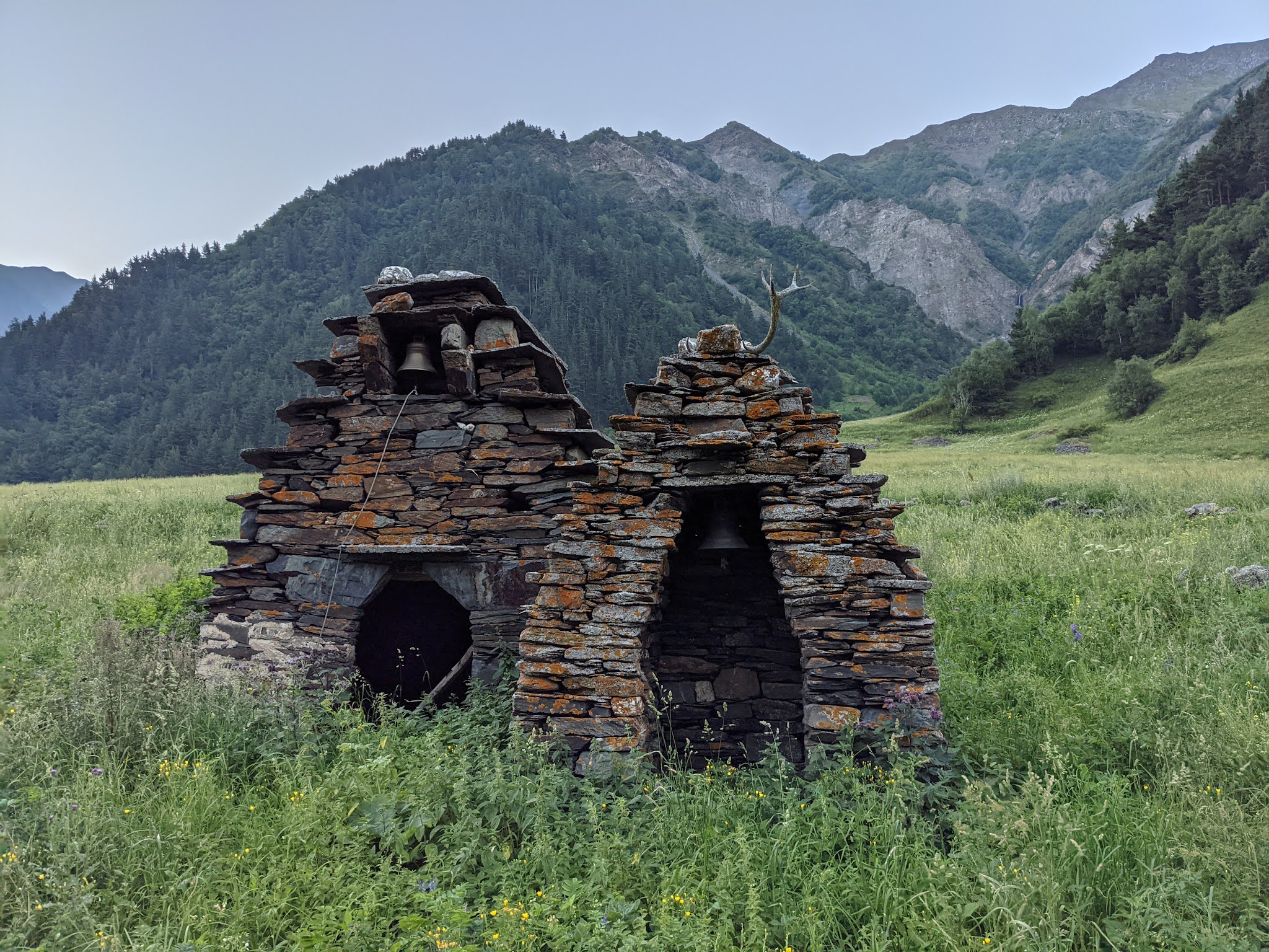
In the morning, passing through a small settlement, incidentally the first in five days, I saw such ancient prayer places...
The landscapes continued to amaze with their variety and scale... And the most powerful effect is that you are alone in all this grandeur and beauty... A hike that kills your fears and nurtures spiritual strength...


Having completed the route in the village of Juta, from where I started my journey seven days ago, I almost immediately hitchhiked a ride to the settlement of Kazbegi (Stepantsminda)... A Georgian guy who races in Formula 3 picked me up. He drove as if he was on his racing machine, taking turns from the opposite lane and at such speeds that I was almost regretting he picked me up... But I literally flew into the settlement, and I still had plenty of time to find where they make fresh khachapuri in a tandoor...


After eating khachapuri with cheese, accompanied by Georgian tomatoes, and grabbing another one for dinner, I headed towards the main trail towards Mount Kazbek... View of the settlement of Kazbegi...


Here, as is traditional for me, I lit a candle in memory of a dear departed soul... It turns out that for the third year in a row, during my solo hikes, I visit iconic cathedrals and churches, and naturally, a certain ritual of remembrance has developed...


Having reached an altitude of 3000 meters, I set up my tent overlooking the famous five-thousander among climbers, Mount Kazbek... After six days of almost complete solitude, I returned to the tourist stream...


Near the camping spots is a tourist house where one can stay in more comfortable conditions...


Descending back to the settlement of Kazbegi at nine in the morning, I managed to catch the minibus that was the first to depart for Tbilisi... Thus ended the main part of my journey through the Caucasus Mountains of Georgia...
Очень круто. Даже на более-менее туристических маршрутах в этом году, говорят, всё крапивой поросло и собаки проходу не дают. А пойти соло в такие дикие места это вообще для меня немыслимо страшно. Вы этот маршрут заранее как-то планировали, составляя из пройденных другими gpx треков или как-то ещё?
ReplyDeleteДякую за коментар... Мені саме хотілось пройти диким маршрутом, а тому я звернув увагу на район Джути... На мапах Google навіть видно наскільки дикою є та місцевість, . Мені подобається самому промальовавувати кожен свій маршрут (дивлюсь як проходять червоні-жовті маршрути на туристичних карта, та поєдную їх так щоб або утворилось кільце або щоб пройти з одного кінця в інший, та щоб максимально захопити високі гори), я завчасно планую яким маршрутом буду йти, та з яким темпом... Але цього разу через поганий стан стежок, я в процесі кардинально змінив свій план ... Мене здивувало, що вказані на мапах стежки (позначені червоними,жовтими лініями ) в реальності або майже відсутні, або в дуже поганому стані. Про маркування взагалі нема що казати... Замість кільця в мене вийшла вісімка, я пройшов менший кілометраж ніж планував, та зате не було "унилих" ділянок, тільки гори, тільки хард кор...
DeleteХардкор не то слово) и собаки и и сыпухи эти выглядят крайне рискованно. я сам в Грузии сейчас и хотел бы прогуляться то ли на Абуделаурские озёра, то ли в Сванетии. Потому хочу примерно представлять на что подписываюсь. Правильно ли я понимаю, что даже если есть треккинговая карта местности, то рассчитывать на хорошее состояние троп не стоит, как и на нормальную маркировку по пути? Кроме физической сложности, есть ли дополнительные трудности по участку от Джуты до Рошки, перевал в данный момент там в каком состоянии? У меня тут и полноценные горные ботинки и лёгкие для трейлраннинга, достаточно ли будет лёгких? На фотках не увидел в чём вы были. Ну и про стафф интересно узнать тоже. Не ожидал увидеть палатку quechua, как она себя показала? Если положительно, было бы интересно узнать модель. Был ли с собой фильтр для воды, пили сырую или кипячёную? Наверху воду можно брать только из озёр, или есть источники? А вот рюкзак опознать не удалось, вижу что оспрей, это kyte, levity или что-то ещё? Прошу прощения что завалил вопросами, ваш опыт кажется ценным.
DeleteОтже... Від Джути до Рошки все дуже просто, ясно, та без дикості, там навіть туристів багато можна побачити... Перевал проходиться просто, всюди тропи, та тільки на спуску трохи зорієнтуватись треба, та трохи сипухою пройти... Фактично озера це найгарніша частина... Мій же маршрут був трохи більше ніж побачити саме гарне... Я рекомендую піти до озер, спуститись до Рошки, а з Рошки піднятись на перевал Sadzele, можна зробити радіалку на перевал Arkhotistavi, та повернутись до Джути. Маршрут з радіалкою займе всього 40 км... Найкраща видимість зранку, тому краще підійматись на перевали вранці. В тому районі всі маршрути хожені та проблем з тропами нема. На рахунок взуття... Я вже давно відмовився від гірських чобіт, для хайкінгу найкраще трейлові кросівкі (без гортексу, гортекс довго сохне :)). Я ходжу зараз в Asics Gel Sonoma 6, ще подобаються Altra Lone Peak . Кросівки обов'язково мають бути більші на пів розміру... Рюкзак Osprey Talon 44, але в мене розмір S, то там здається 40 літрів. Палатка одномісна з Декатлону - Forclaz Trek 900 (1.3 кг, силіконка) . Для такого як в мене хайкінгу абсолютно нормально показала себе, особливо зважаючи на ціну (120 евро)... Якщо врахувати, що в поході по Альпах (https://svirik.blogspot.com/2020/09/ItalyAlps.html) я брав тільки тент-пірамідку (400 гр), а Піринеї ( https://svirik.blogspot.com/2019/09/transpirenaika.html) взагалі з бівуачним мішком з тайвеку пройшов, то це був тест комфорту, до того ж цього разу я вирішив не брати трекінгові палиці... Про що не раз пошкодував... Тент-пірамідка напевно кращий варіант, оскільки палиці все ж брати варто, а якщо вже є палиці то і пірамідку є сенс брати. В палатці я використовував нудувний коврик Naturhike (400 гр), та не брав бівак (200 гр), який беру при ночівлі в пірамідці. Коли беру пірамідку, то не беру взагалі надувного коврика, беру фольговану підстилку (100)... Фільтр для води в мене був, та в тому районі він не потрібний, там всюди досить чисті струмки. Взагалі я не носив з собою про запас води, тільки одна пляшка на 700 мл. Проблеми з водою тільки в місцях де маршрут йде виключно по хребту, та це не про околицю Джути та Рошки. Воду зі струмка можна взяти відійшовши десь 500 метрів від Абаделаурських озерах нижче до наступного, так званого зеленого озера... Дуже круто що запитуєте, я з радістю ділюся інформацією та досвідом, якщо є запит...
DeleteВзагалі під кожну задачу своє спорядження в залежності від особливостей походу, та формату в якому хочеться його пройти... В різному форматі проходження - трохи різне спорядження ( вибірка з моїх походів на великі відстані та різні формати проходження - https://svirik.blogspot.com/search/label/longway ) В Грузії я спробував самй комфортний варіант, та не самий легкий... Палатка, система приготування їжі, балон, надувний килимок... Та такий формат мені також зайшов...
Deleteблагодарю за подробности! у меня salomon sense ride 2, тоже по большей части только в них и выхожу в горы, но иногда кажется что на сыпучих камнях или топкой грязи обычные высокие кожаные ботинки дадут больше комфорта. спасибо что рассказали и о других подробностях выбора снаряжения, возможно что-то из этого пригодится мне в будущих выходах.
Delete